

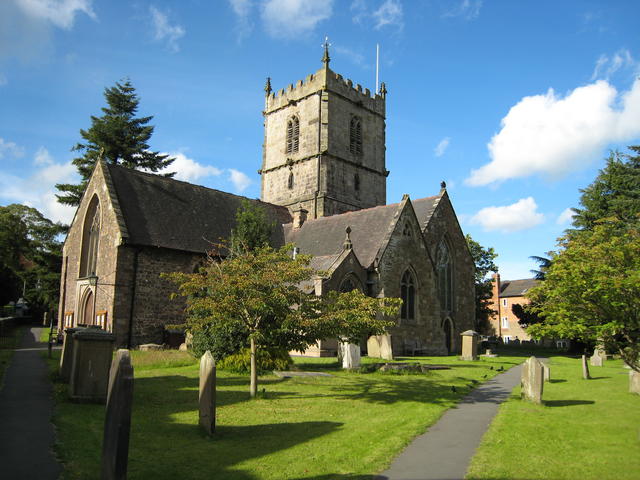
Church Stretton is a small town in Shropshire, England, 13 miles (21 km) south of Shrewsbury and 15 miles (24 km) north of Ludlow. The town was nicknamed Little Switzerland in the late-Victorian and Edwardian period because of its landscape and became a health resort. The local geology includes some of the oldest rocks in England and a notable fault is named after the town. Today, Church Stretton is a busy market town in the Shropshire Hills Area of Outstanding Natural Beauty.
People have lived in the Stretton Gap (or Dale) for thousands of years; an Iron Age hillfort on Caer Caradoc overlooks the town. The name "Stretton" is derived from the Old English words stræt meaning "Roman road" and tun meaning "settlement"; a Roman road, Watling Street, runs through the Stretton Gap, though the town (and adjacent settlements) were not historically located on this road – during the "Dark Ages" the settlements grew a short distance away from the old thoroughfare, for defensive purposes. Today the modern A49 road, which was constructed on its current alignment through the Stretton Gap in the late 1930s, runs along a similar course to the Roman Road. The Roman road was historically known as Botte Street.
The settlements of Little Stretton, Church Stretton and All Stretton (until the late 19th century regarded as separate townships) formed the manor of Stretton or Stretton-en-le-Dale. The Domesday Book of 1086 recorded 35 households and a mill in the manor. Church Stretton became the largest of the settlements, with the manor's parish church and market located there, and being where Bristol Road had a junction with the road to Much Wenlock and the Burway - a route over the Long Mynd. At the time of the Domesday Book, the manor came under the hundred of Culvestan, a Saxon hundred that was amalgamated during the reign of Henry I — the Strettons then came within the upper division of the hundred of Munslow.
The town was first granted a market charter by King John in 1214, for a weekly market on Wednesdays, but by 1253 the market day had changed to Tuesdays. In 1337 a new charter was granted by Edward III and it authorised a weekly market to be held on Thursdays. The market is still held every Thursday, in the square on the High Street, which has been the town's market place since the 13th century. Much of the town was destroyed by fire in 1593 and many of the present half timbered buildings in the town centre date from the time of the rebuilding.
The High Street was for many centuries known instead as the Bristol Road, being the road from Shrewsbury to Bristol. It was once a much wider street within the town, with the churchyard of St Laurence bordering directly onto the street. Over time buildings were erected on the street, in a similar fashion to other English market towns, such as in Ludlow. The High Street, which is a narrow street, is effectively only the eastern side of the original Bristol Road thoroughfare through the town. It was made more open when the old market hall was demolished to form the present town square. During the 18th century, Church Stretton began to develop as a spa town, attracting those who sought to escape the new urbanisation and industrialism of Britain.
Church Stretton was nicknamed "Little Switzerland" in late-Victorian and Edwardian times, because of its surroundings and the way many houses hug the hillside. Church Stretton railway station opened on 20 April 1852 as part of the newly created Shrewsbury and Hereford Railway. It was originally situated to the north of (what is now known as) Sandford Avenue and the old station building still remains, but is no longer in railway use. Sandford Avenue had been for centuries called Lake Lane and became Station Road with the arrival of the railway in the town, before becoming Sandford Avenue in 1884.
In 1914 the railway station was moved just to the south of the Sandford Avenue road bridge, where it continues to the present day. New railway station buildings were erected, but these were demolished in 1970, the station having become unstaffed in 1967. Local property developer Ralph Beaumont Benson (1862–1911), who lived at Lutwyche Hall in nearby Easthope, is responsible for the naming of Easthope Road, Essex Road (after his wife), Beaumont Road and Lutwyche Road, all in the centre of the town and part of the town's expansion in the early 20th century.
The Long Mynd Hotel on Cunnery Road opened in 1901, originally as "The Hydropathic Hotel" (or "the Hydro"), at a time when the town was popular as a spa. Today it continues as a hotel and has a number of features and activities in its woodland grounds; it is also a wedding and conference venue. In 2012 it was sold by the local Chapman family (who ran it since 1977) to 'HF Holidays', a national company.
During and just after the Second World War, from 1940 to 1946, St Dunstan's, now Blind Veterans UK, was based in the town. The charitable service (for blinded armed forces personnel) was moved from Sussex as Church Stretton was thought to be a safe location. Some 700 people were trained during this period in Church Stretton in an industrial training centre set up at a malthouse in Sandford Avenue. The Long Mynd Hotel, the Denehurst Hotel, the Brockhurst Estate and Tiger Hall were the most notable buildings taken over by St Dunstan's in the town. The Long Mynd was considered to be a potential landing place for German parachutists, although Church Stretton avoided the aerial bombing of the war; the only death recorded in the district by the Commonwealth War Graves Commission of a civilian war casualty was of a Firewatcher from Manchester who died while being treated at the St Dunstan's Hospital.
A small market hall stood on the High Street but was demolished in July 1963 and the site has become a town square, and is still used to hold markets on. The first market hall – a timber-framed construction – was built in 1617; this was replaced by the second market hall (called the Town Hall) in 1839, which was a stone and red-brick construction.[22] Today the Silvester Horne Institute (extended and refurbished in 2011)[23] is the town's main meeting place for societies, polling, public meetings and exhibitions. In recent years volunteer members of the Community Group have transformed Church Stretton into the Town of Flags: thanks to local grants they have purchased over 120 flags - English, Union and foreign - and these are regularly flown in the town centre on special occasions throughout the year.
Historically the town was known for its textiles, using the abundant local wool, and a notable location for this industry was Carding Mill Valley. The carding mill there was built in the 18th century, and named after a stage in making cloth, the three stages being carding, spinning and weaving. Carding would have been done by children, and involved using a hand-card that removed and untangled short fibres from the mass of raw material. The cards were wooden blocks with handles and covered in metal spikes, which were angled (to make it easier to untangle) and set in leather. When untangled, the material would be spun, and then woven into the final product.
The carding mill closed and was demolished at the beginning of the 20th century, though the adjacent factory building remains in the valley today. The valley it is in took the name "Carding Mill Valley", and is now a tourist attraction and well-known starting location for walkers (being at the heart of the Long Mynd range). It is owned (along with the entire hill range) by the National Trust, who have a visitor centre there. The mill building itself has been converted into flats and a number of other private houses exist near it and the visitor centre, forming a small settlement in the valley.
Vehicles (and therefore most visitors) have to drive up from the town, from Shrewsbury Road, to access the valley. Cars may drive as far as the car park situated about a mile up the valley. This car park was at one time an open-air swimming pool. A sign indicating water depth still stands in its original position.
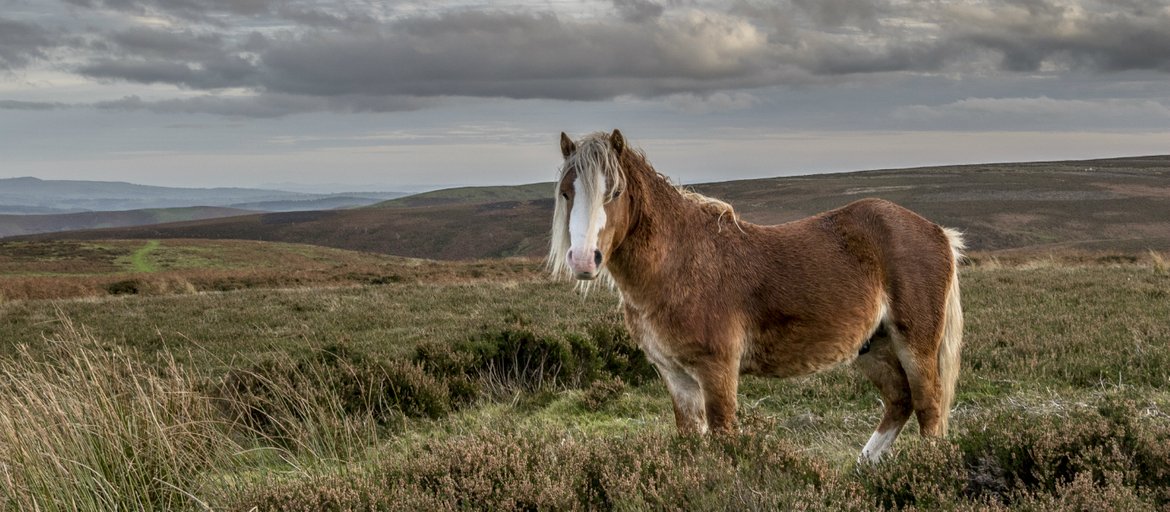
Take a walk across the wildlife-rich heathland and enjoy the views across the Shropshire Hills, or simply play in the stream in the valley. Covering as much as 2,000 hectares (4,942 acres) of heather-covered hills with stunning views of the Shropshire Hills Area of Outstanding Natural Beauty and the Welsh hills, this is an important place for wildlife, geology and archaeology.
There are paths for walking, cycling and horse riding, you can even drive to the top of the hill to take in the views. In Carding Mill Valley there are excellent visitor facilities including a tea-room, shop and car parking. In Carding Mill Valley you can play in the stream, watch birds from the hide, pond dip and relax with a picnic; or you can simply use the Valley as your base for the day and head on up the hill for an adventure. You don't have to venture far out of the Valley to find your own piece of solitude on the Long Mynd.

The Long Mynd is a heath and moorland plateau that forms part of the Shropshire Hills in Shropshire, England. The high ground, which is designated as an Area of Outstanding Natural Beauty, lies between the Stiperstones range to the west and the Stretton Hills and Wenlock Edge to the east. Much of it is owned and managed by the National Trust.
The Long Mynd, which is approximately 7 miles (11 km) long by a maximum of 3 miles (5 km) wide, has steep valleys on its eastern flanks while its western side is marked by a slope that rises in a steep escarpment from the wide valley of the River East Onny. It is surrounded by the principal settlements of Church Stretton, Little Stretton and All Stretton, Pulverbatch, Smethcott, Woolstaston, Asterton, Myndtown, Wentnor and Ratlinghope.
The highest point on the Long Mynd is Pole Bank (1,693 ft, 516 m); this and the adjacent hill of Caer Caradoc (1,506 ft, 459 m) are classed as Marilyns. The name Long Mynd means "Long Mountain", the second element being Brittonic in origin. In modern Welsh it is named Mynydd Hir, which has the same meaning.
The geology dates back to Precambrian, and during the time would have been 60° south of the equator, the same latitude as the Falkland Islands. Shropshire would have been at the very edge of a large continent near the sea, which was being buckled by tectonic activity, causing volcanoes to form. The area had broad rivers; evidence of mudflats has been found. The rivers would have flowed out to sea, creating large estuaries; over time, the mudflats would have built up, and volcanic eruptions deposited ash in layers between the sand and mud.
The primary rock of the Long Mynd is sandstone, usually coloured purple or grey. The volcanoes created the nearby Stretton Hills and the Wrekin, and eruptions would have been frequent. There are layers in the rocks of the Long Mynd that were previously described as raindrop marks. Unpublished research, including electron micrographs, by the now deceased Professor Martin Brasier, showed that these are actually ichnofossils created by an unknown Ediacaran biota.
Field observations of the stratigraphy present, and its laminar nature, leave no doubt that they are in a marine environment; the absence of infilled or mineralised syncresis (shrinkage cracks) further add to this. Examples of these fossilised marks can be viewed today in the National Trust Tearoom Exhibition, in Carding Mill Valley. The layers of rock built up over the millennia to create an approximately 23,000 ft (7,000 m) thick layer composed of sand, mud, silt and very occasional thin ash bands. The stratrigraphy, mineral compositions and surrounding volcanology suggests an infilling island arc basin.
Towards the end of the Precambrian period, the volcanoes ceased their eruptions, and the rivers had dried up. Instead the forces that created the volcanoes caused the new rocks to lift and fold, creating mountains and valleys in the area. Much of the rock was melted during this period, underneath the Earth's crust, causing the mountains to continually change towards the latter part of the Precambrian. The Church Stretton Fault zone probably formed during this period. It is still active today. The hill Caer Caradoc adjacent to the Long Mynd and from the same time is volcanic in origin, and is thought to be the remnants of the great mountain chain.
During the Cambrian, Shropshire was flooded by the sea, after the Global Ice Age ended 545 million years ago. Thick layers of beach pebbles and white sand were built up against the sea cliffs that were once molten lava. During this time, the shallow sea played host to the huge explosion of new life which occurred during the Cambrian. Shropshire has some of the most historically important evidence in the explosion of life and in the naming and dividing of the Cambrian period. Trilobites that are found in the county are internationally important for deciding how the Cambrian is divided into smaller segments of time.
The Ordovician had Shropshire back to volcanic activity, and saw the county temporarily split in two, along the Pontesford – Linley fault line. Everything west of this line was ocean, while the east was dry land. The Iapetus Ocean was closing, bringing the two-halves of Britain towards each other, and volcanic eruptions created the Cumbrian Mountains and Snowdonia. Shropshire also saw volcanic activity. To the west of the Pontesford – Linley fault, volcanic rocks have been found. The other side of the fault line was quieter. The land was slowly eroded, and the sea gradually flooded it, so that only the tops of hills could be seen, such as the ancient Caer Caradoc. Towards the end of the Ordovician, the sea levels dropped, due to another ice age. An interesting observation of this erosion can be found in the stratigraphy as a sea stump (an eroded sea stack).
The Silurian period, occurring 439 million years ago, has been well preserved nearby, in Wenlock Edge. During this time, Shropshire would have been flooded again by shallow sea. Wenlock Edge would have formed during this time, and the fossils of ancient corals and shellfish can be found all along the edge, preserved in limestone. Towards the end of the Silurian the Iapetus would have fully closed, and England and Scotland were joined. The closing of this ocean was important to geology in Great Britain. It caused most of our hills and mountains to align along the fault, northeast to the southwest.
During the Devonian, the newly formed Scottish mountains had rivers flowing all over the land. Shropshire was no exception; these new rivers caused thick deposits in the area. Most of the rocks from this era are red sandstones, caused by iron in the rock. The area was known as the Old Red Sandstone Continent. These river sediments have traces of fossilised fish. Shropshire would have remained above water until the end of the Devonian, when the seas rose once again.
The Carboniferous was a time of great change for the area. Shropshire would have been near the equator, and the Old Red Sandstone continent had been eroded away; in the early part of the era, the county was under a shallow sea. However, tectonic activity pushed Britain out of the sea. South of Shropshire this effect was felt greatly, though Shropshire was relatively quiet. Mountains to the north were being worn down by rivers, creating enormous deltas that were colonised by plant life. A tropical forest took hold all over Shropshire, with ancient tree ferns and horsetails. Shropshire eventually crossed the equator during this era, and became a part of Pangaea during the Permian; the area would have been very similar to the Sahara Desert, and would have been in the vicinity, around 20° to 30° north of the equator.
The Triassic, Jurassic, Cretaceous and Tertiary were very quiet in Shropshire, and very little evidence can be found from these periods. The last Ice Age during the Quaternary has its effect on all of Shropshire, shaping the landscape as we see it today. The Long Mynd would have been under a thick ice sheet, several hundred metres thick. As the ice melted, it carved out the valleys and hills of the Long Mynd massif we see today. The small rivers, streams and brooks still very slowly carve out the valleys. The springs and bogs play a part in Church Stretton's economy, as the people bottle the mineral water that comes from the Long Mynd.
Today the steep and narrow valleys are covered in a thin layer of soil, with a low pH, able to support only strong grasses, rushes and heathers. Beneath the soil the evidence of the ancient and chequered past can be seen, and the rocky outcrops and scree slopes are excellent places to view the different layers of ancient rock. Since 2006, Cambridge University has monitored seismic activity in Long Mynd. The broadband seismometer is connected to the internet, and real-time traces can be viewed online.
** – Early History – **
** – Visiting – **
Spring offers some special moments on the Long Mynd. With new life popping up all around and thousands of acres to explore there are lots of ways to enjoy yourself. Whether you want to go mountain biking, horse riding, walking or swimming they have got it all here. Here are 10 suggestions.
The shuttle bus service is a great way to get out exploring across the Long Mynd and Stiperstones. Traveling this way gives you a much greater appreciation of this fantastic heathland landscape managed by the National Trust and Natural England. The Long Mynd and Stiperstones Shuttle Bus is open for business again from May Day Bank Holiday weekend and is running on the following dates: Weekends and Bank Holiday Mondays, starting early May to 30th September.
This fantastic service picks up in Carding Mill Valley and Church Stretton, traveling across the Long Mynd to the Stiperstones, via Bridges on the way. Once at Stiperstones you can visit the Bog Centre or Snailbeach mine. Using the bus is a really good way of seeing more of the hills if you've got limited time or if you find you just need a lift back to Carding Mill Valley. It's even useful if you want to head to Bridges for a pub lunch and you don't want to walk back! This way you can sit back, relax and take in the views.
Both Long Mynd and Stiperstones are SSSIs for their geology, ecology and archaeology. Both sites are upland heathland, this delicate habitat is managed by the National Trust and Natural England both organisations aiming to conserve and protect these special places. For full details on the route and prices head to the Shropshire Hills Shuttle Bus website.
** – Reservoir Walk – **
This walk starts from Carding Mill Valley at the heart of the Long Mynd and takes you on a gentle walk past the mill ponds and up the reservoir bank. Classified as Easy, the walk is half a mile and should take about half an hour. It is dog friendly. There is a tea room, gift shop and toilets.
Start: Carding Mill Valley.
** – Waterfall Walk – **
This walk starts at Carding Mill Valley at the heart of the Long Mynd and takes you on a gentle ascent along the stream to the four metre cascade at the picturesque Lightspout Waterfall. Classified as Moderate, the walk is one and a half miles long and will take up to one and a half hours. It is dog friendly and there is a tea room, gift shop and toilets with disabled and baby-changing facilities. Head up to the waterfall after a few days rain and this is a wonderful sight.
Start: Carding Mill Valley

** – Pipe Walk – **
This walk is a great way to see some beautiful views and also to really get to the heart of 'those blue remembered hills', as mentioned in the poem by A E Housman. See hints along the way to the area’s industrial past. This walk also has a strong focus on water, following the stream up to the dark-blue reservoir, along the Pipe Walk and finishing at Lightspout waterfall. Classified as Moderate, this walk is one mile long and will take about one hour. It is dog friendly. Tea-room, gift shop, toilets and car park (free for NT members) available at Carding Mill Valley.
Start: Carding Mill Valley.
** – To the top of Long Mynd – **
A walk to the top of the Long Mynd. This walk takes you to the head of Carding Mill Valley and up to the highest point of the Long Mynd. From the top you can take in fantastic views across Shropshire and beyond. Classified as Challenging, this walk is five miles long and will take about two and a half hours. It is dog friendly. Tea-room, gift shop, toilets and car park (free for NT members) available at Carding Mill Valley.
Start: Carding Mill Valley.
** – Ratlinghope, across Long Mynd – **
A walk to Ratlinghope across the Long Mynd, This walk takes you round to the quieter, west side of the hill. You can even stop at The Bridges pub half way round if you like! This is a long walk, ten miles, and will take up to 6 hours so the break would, no doubt, be welcome. Classified as Challenging, the walk is dog friendly. Tea-room, gift shop, toilets and car park (free for NT members) available at Carding Mill Valley. The Bridges Pub is open from 11am – 11pm every day.
Start: Carding Mill Valley.
** – Facilities – **
General:-
Family:-
Access:-

Location : Carding Mill Valley, Church Stretton SY6 6JG
Transport: Church Stretton (National Rail) then 1 mile. Bus routes: Shrewsbury to Ludlow (435, 540), alight Church Stretton, ½ mile. Shuttle bus weekends and Bank Holidays (Easter to October).
Opening Times : Daily, dawn to dusk.
Opening Times Tea Room: Daily, 10:00 to 17:00.
Tickets : Free. Summer Car Park £4.50; Winter Car Park £3.00.
Tel: 01694 725000

