

The line was originally two separate schemes: the Tottenham & Hampstead Junction Railway (authorised 1862) and the Tottenham & Forest Gate Railway (sanctioned 1890). The T&HJR was planned to run from Tottenham Hale to Gospel Oak, and opened in July 1868 from Tottenham Hale to Highgate Road, just short of Gospel Oak. The station opened at this time. The origins of the name Holloway are disputed; some believe that it derives from Hollow, or Hollow way, due to a dip in the road caused by the passage of animals and water erosion, as this was the main cattle driving route from the North into Smithfield. In Lower Holloway, the former Back Road, now Liverpool Road was used to rest and graze the cattle before entering London. Others believe the name derives from Hallow and refers to the road's historic significance as part of the pilgrimage route to Walsingham. No documentary evidence can be found to support either derivation; and by 1307, the name Holwey was applied to the district around the road. The main stretch of Holloway Road runs through the site of the former villages of Tollington and Stroud. The exact time of their founding is not known, but the earliest record of them dates from the Domesday Book. The names ceased to be used by the late 17th century, but are still preserved in the local place names Tollington Park and Stroud Green. The original route, from London, led through Tollington Lane, but such was the state of this road by the 14th century, that the Bishop of London built a new road up Highgate Hill, and was claiming tolls by 1318. This was the origins of the Great North Road, now the A1, which passes through Holloway.
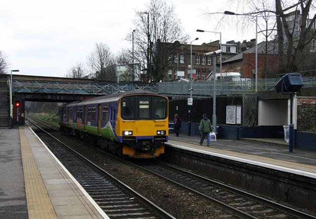
Station facilities are basic with little at street level other than a few signs to indicate the presence of a station. Holloway Road passes over the line and steps and ramps for wheelchair users, buggies, bikes etc. on either side of the bridge lead directly down to the platforms. There are information points, CCTV cameras, information screens and loudspeakers. There are brick-built shelters on each platform and the station staff operate out of a small portable office. Signs of the station's past remain. The building which used to be the ticket office can be seen beside the south entrance (for trains towards Gospel Oak). A footbridge over the track remains but this is closed and the only way over the track is by Holloway Road. The platforms were originally built to accommodate longer trains. The unused sections of platform remain but are closed and in a poor state of repair. The signal box at the end of the platform is still in use. As of summer 2008, the station has been repainted and re-signed in London Overground colours, with the green-painted staircase railings (for example) of the former Silverlink franchise giving way to Overground orange. There are rumours of an interchange station to be built at Tufnell Park where the Gospel Oak to Barking line crosses the Northern line, on the site of the now demolished Junction Road station but as yet there is no official word on if or when this work would be carried out. The station is in Travelcard Zone 2 and has wi-fi, boarding ramps, and help points, but no toilets.
Connections: London Buses routes 17, 43, 263 and 271 and night route N41 serve the station.
